Monday, September 1, 2014

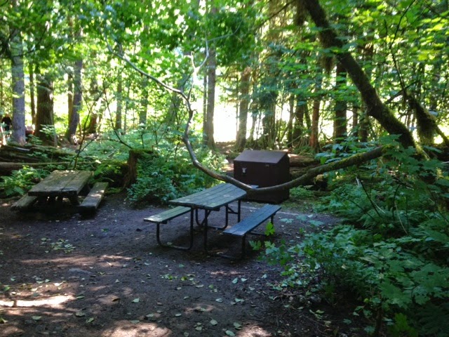
Staircase Campground, Olympic National Forest


      First thing to know about this campground is that it is well off the beaten path but well used. It is at the very end of Lake Cushman, at the bottom of the Olympic peninsula or about 30 minutes north of Shelton, and the drive to it is windy, sometimes not paved but absolutely beautiful.
     The campground itself is quite a stunning and most of the sites work much better for tent campers as there isn"t much room for maneuverability of camper trailers but sites 1-6 offer possibilities for small camp trailers or campers. There are no hookups or showers but they do offer running water and flush toilets. It is first come first serve and has a ranger station that offers a variety of educational shows during the summer at their amphitheater. The campground is settled next to the Skokomish river which offers a little bit of fishing and some great water play. There are only around 40 some campsites and we were camping over the busy Labor Day weekend when it was filled to capacity but it didn't ever feel busy or crowded.

There are a variety of trails that start off in this area that range from short day hikes to back country hikes.  Our family decided to tackle the 2 mile hike that starts in the parking lot and goes up and around the rapids in the river, hence the name Rapids trail. It was a gorgeous hike but is not for those that are not sure footed. The trail starts off wide and flat but quickly turns rocky and goes both uphill and downhill. If you take the family, keep an eye on the smaller kiddos and don't bring a stroller. We were here during Labor Day weekend and the river was actually not raging in the least but the views this hike offered were breathtaking. I hope to come back in the spring when the river is running at its highest.We hope to come back in both the fall, for the full array of colors that could be offered and the spring to enjoy the full power of the river.


Sunday, July 27, 2014

Colonial Creek Campground, North Cascades National Park, Washington

 Welcome to the North Cascades National Park. This is one of the most beautiful places in Washington state but a couple warnings. #1- If you get car sick, take some meds or be the driver and #2 Plan to take some time to enjoy the beauty of this area. If you are making it a day drive or part of the mountain loop drive, take your time and check out some of the overlooks. They are worth it.  We decided to make it a weekend camping trip and loved every minute of it. When you start up the highway you follow this amazingly beautiful river for a spell until you get to Ross and Diablo lakes. The color is absolutely gorgeous.

There are numerous waterfalls and overlooks along this curvy road.


You can check out the Ross Learning center. Just fair warning the roadway is narrow and you cross over a dam so if heights is an issue beware.
The campground we chose was the Colonial Creek campground. The campground is in old growth and absolutely stunning! It is definitely more suited for tent or small trailer camping as quarters are tight. But for as close as everyone was it was still a quiet and relaxing experience.
The wildlife is to be expected blue jays, squirrels and chipmunks will raid your camp if you leave anything out and the possibility of larger wildlife is there so be aware and store food in the lockers available.

If you are into hikes there are quite a few throughout the area. Two of these hikes are based out of this campground. 

If you are looking for a beautiful area to get away to, or a gorgeous drive this would be an excellent choice.

Tuesday, May 27, 2014

Hurricane Ridge, Olympic National Park

Hurricane Ridge
Black tail Deer
 The Olympic National Forest is one of the true gems of Washington state and it has so much to offer  that you could not possibly view it all in one day. One of the places that we chose to explore over the Memorial Weekend is Hurricane Ridge, which is about 17 miles south of Port Angeles. This road is crazy and I will be completely honest with you if you have a fear of heights this may not be your cup of tea. You climb steadily for those 17 miles on roads that are not always very wide and rarely have a guardrail. BUT if can brave this road there is so much to see. Unfortunately for us it was a cloudy weekend and we weren't able to take in much of the view but even without the view the area was breathtaking. On our drive up and down we were treated with glimpses of the wildlife that was beginning to stir. And at the top of the road is a nice visitors center that offers information on the area, a gift shop, a cafĂ© and a short video about the national park itself. My advice would be to go later in the summer, probably July, when the snow is mostly gone and the wildflowers will be in bloom.  There were a few flowers blooming, as you can see below, but I know more will show once the ground warms up. There are quite a few trails up here that on a clear or semi-clear day produce beautiful views. Definitely a must for the outdoor enthusiast.

View from the top on a cloudy day
Snow at the top of Hurricane Ridge on Memorial Weekend.


Indian Paintbrush


Lupine

Dungeness Spit, Clallam County Campground & National Wildlife Refuge

The start of the Dungeness Spit
     So for my family Memorial Weekend was a four day weekend so we decided to venture a little farther from home. We ended up on the peninsula of Washington State, specifically at Dungeness Spit which is just a couple miles outside of Sequim, WA. There is a great little county campground that offers two loops with a total of around 60 campsites (sites 1-33 are first come first serve) None of the sites have hookups but most are beautiful with tons of foliage throughout. There are centrally located bathrooms with clean showers($.25 per 2 min) and a playground for the kiddos. We had a very nice experience here as both the camp hosts and the park rangers were very friendly and helpful.
    Just a heads up, the campground is separate from Dungeness Spit one is county and one is considered a nation park so if you pay to camp that does not cover the fee to go and walk the spit (which was $3.00). The hike out to the lighthouse is 5.5 miles from the parking lot and for the most part is not overly strenuous, the hardest part is getting to the beach itself. Make sure and pack water and snacks as it could take you a couple hours, unless you just cruise along and don't look for treasures. Our family did not come prepared and made it just 2 miles short of the lighthouse.


Even though we didn't make the lighthouse we still really enjoyed ourselves. This beach is the perfect combination of the inland and ocean beaches. We were able to find a lot of fun treasures;


This beach had a lot to offer as it has been left relatively untouched. No one is allowed to drag anything off the shore since it is a wildlife refuge. The pole to the right is actually a tree stump that was buried in the sand upright. For my family it was a great experience to be able to walk along the beach without the worry of crazy beach drivers or trail horses running us over. Just my advice but if you plan to do this hike take plenty of water, your camera, some snacks, and good tennis shoes. This is a great place to take your time and enjoy the beauty of the shoreline.


Sunday, May 18, 2014

Alder Lake-Rocky Point Campground

     Well I spent the week deep cleaning the camper and decided I couldn't wait to take it out until next weekend. Sooo, a last minute camping trip came about. We didn't want to go to far so we headed down to Alder Lake which was about an hours drive for us from our side of Joint Base Lewis-McChord but it was worth it.


     The lake is long and shallow and quite beautiful and we were lucky enough to have decent weather for most of our time. It is a pretty clean lake that can be fished or swam in. My family enjoyed both. We chose to camp in the Rocky Point Campground which is at the end of the lake closest to Elbe, WA. It is small campground (24 sites) but each site has electric and water and although the sites are on the small side they are kept clean. There is a central outhouse that is heated and also kept very clean. The only drawback is that you are right next to Hwy 7 but to be honest we weren't really bothered by the highway unless a large group of motorcycles came by. If you decide to go try and get site 409 as it has the best view and a nice trail down to the beach.
View from our campsite


 Although the term beach is a bit of a stretch as most all of it is just huge rocks you have to climb around(probably why it was named Rocky Point). I will say that if you have small children this probably isn't the best choice as the beach itself could be pretty dangerous, there is a larger campground on the northern side of the lake where it might be a bit safer for smaller children.


My son getting his "Sheldon" on.

      Even though we did head out to go camping my oldest and I did do a little exploring and checked out the small town of Elbe, WA which was just about a mile or two down the road. This town is very small but full of some great things. The two oldest buildings here are their church and general store(both are pretty cool) and they have a railway museum and, wait for it, a railroad hotel called The Hobo Inn. Now I didn't stay in it, obviously, but the concept was pretty cool. You rent out a train car to stay in. Next the hotel they have a pizzeria that was fantastic and is also in a train car. There is also another restaurant that is in a train car, but sadly we didn't try that one out. For such a small town there was plenty to see.
Great pizza place!!

All in all we really liked the lake and the little town of Elbe and  will be making more trips back this summer!!!


Sunday, May 11, 2014

Wallace Falls Washington State Park

Well it s that time again, hiking season!! So we started ours off with bang and went to Wallace Falls State Park on Highway 2. I had read in "Best Short Hikes in Washington's North Cascades & San Juan Islands" by E.M. Sterling that it was a little over 2 miles to get to a view point of the falls and the map at the bottom of the hike stated close to the same distance so we set off trekking up the hill. We decided to take the longer but gradual uphill climb of the railway grade trail and it was exactly as advertised, it wasn't overly difficult with plenty of places to take breaks but when we came to the end of this part of the trail (marked as 2 miles) a surprise was waiting for us as a sign proclaimed that it we had an additional 1.5 miles to get to the falls. We were unable to continue further for multiple reasons and was greatly disappointed to have hiked that far and not see the falls. On the way down the hill I turned on my phone's app, Map My Dog Walk, which I have used multiple times to keep track of the distance we walk and according to this app the walk to the end of the railway grade trail was actually three miles long, not two. So all in all, the hike itself was beautiful (and I am sure it would have been stunning if we had seen the falls) but the maps were confusing and seemed off when listing distances. Plan on at least 2 miles in one direction to see the falls(if you take the Woodland trail instead of the Railway grade trail) but it could be up to 3-6 miles total so just plan accordingly. The hike itself was beautiful, as it winds its way through the forest you will get to see a lot of beautiful plant life and small creeks and streams(which are nice if you have a puppy who needs a drink). Here are a few pictures of the plant life and the view at the beginning of the hike itself.